Al Saints' Churchyard
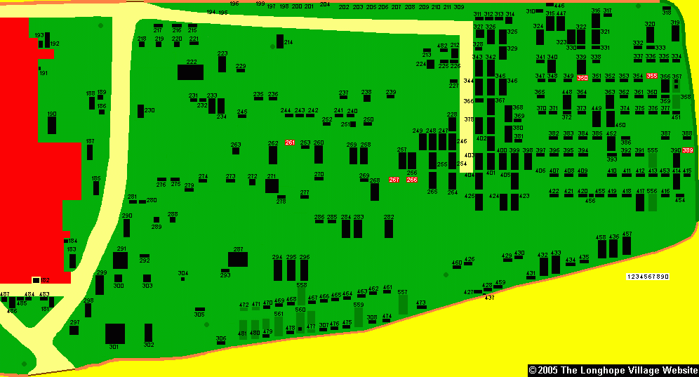
The map below shows the location of each gravestone in Winter 2004/5 and involved a lot of time standing around in the freezing cold. It is one of only two maps of the churchyard in existance that we know of, the other was drawn in 1983 by the Gloucestershire Federation of Womens' Institutes. The church is coloured red, the perimeter wall orange, pathways, gray and grass being green. Any visible headstones or pots are plotted in black with dark green patches identifying the burial plot. The south churchyard was redrawn, to scale, in Easter 2006 but the north side remains as it was drawn in Winter 2004. Grave numbers that couldn't be identified from 1983 are shown in red. Numbers on the left of the map are ones that have yet to be identified from 1983

Here is the north side of the churchyard.
